[Robot][EN]Hivemapper

0. About


  • Hivemapper

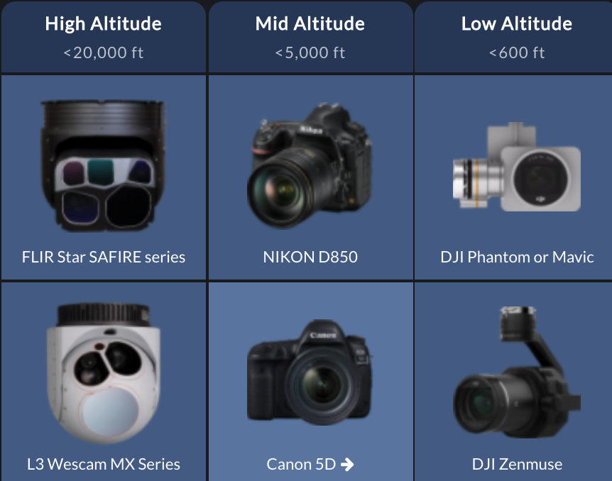
  • Led by Ariel Seidman, Hivemapper is a decentralized mapping network that enables monitoring and autonomous navigation without the need for expensive sensors, aircraft, or satellites.

Hivemapper in 70 seconds
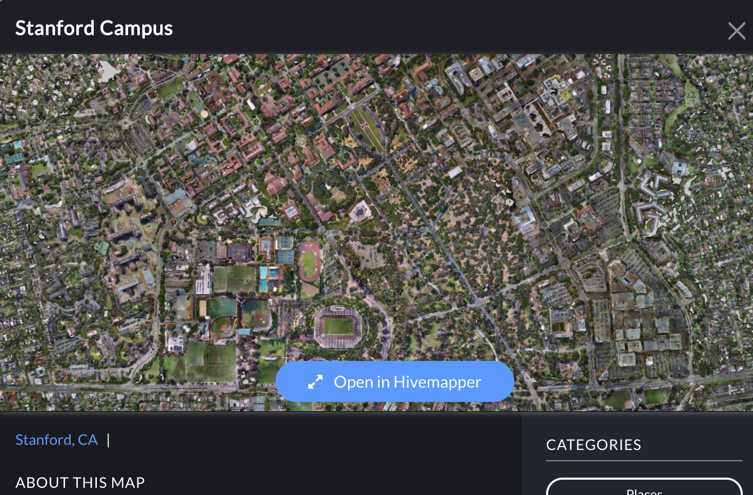
1. Product

1.1. MAP

Map, meet Analytics


  • Powerful visualization and tools gives everyone the ability to quickly and easily get answers that move operations forward.

  • Intergrates with comprehensive data of lidar, terrain and more.
  • Securely access and share maps from any web browser - no downloads or installs needed.

Features


  • Video Search - Click anywhere in the map, and retrieve all videos of that location


  • Timeline - View a location at specific point in time and see how it has evolved


  • Height above ground - Color the map by object height above ground. Identify obstructions for low-altitude aircraft and more.


  • Viewshed - Determine visible and non-visible areas from a given point on your map, especially useful for positioning your cellular stations.


  • Measure - Accurately measure and find coordinate information for any points on the map.

Data Included

  • Streets and Points of Interest
  • Terrain
  • Lidar
  • Uploaded Map Layers

1.2. CHANGE DETECTION

  • Captures physical growth, loss, and disruptions faster than humans can.
  • Augment human analysis with AI built directly into the map.
  • Powerful filtering and sorting powered by Object AI.

Features


  • Change Detection -Video collections automatically generate change detection slices. Compare days to days, days to weeks, and even compare against historical lidar maps.


  • Amount of change - Filter detected changes by amount of change. See precise measurements for any spot.


  • Before and after videos - Instantly retrieve before and after videos of any spot. Compare your changes with true to life imagery.


  • Filter by object - Object AI allows you to filter your Change Detection map by object type like terrain, vegetation, and more.


  • Measure - Accurately measure and find coordinate information for any points on the map.

1.3. OBJECT AI

  • Object AI understands whether the thing on a map is a building, vegetation, road, and more.
  • Hivemapper harnessed AI to segment map by object type, making smart-maps accessible for all.
  • Filter map and detected changes by the objects user care about, powered by AI.

Object Classes


  • Buildings


  • Ground - Natural ground such as dirt, rocks, sand, and grass.


  • Trees


  • Mobiles - Objects that can move such as vehicles, boats, cars, airplanes, people, and animals.


  • Pavement

Stanford Campus, CA. by Hivemapper


Here

2. How it Works

2.1. Collect Video


  • Via any aircraft - Cessna, drone or helicopter
  • Any Camera - GoPro, FLIR or Nikon
  • Any Condition - Fly night or day, sunny or overcast. Hivemapper figures out

2.2. Upload/Build the Map

  • Easy Uploader Tools - No desktop software to install. Just upload to Hivemapper.com
  • Automated map creation - Hivemapper automatically takes the best parts of each video and turns them into a 3D map and Change Detection map.

2.3. Use Map produced by Hivemapper

(Described Above)

  • Map - Powerful visualization and analytics built right into users’ living map
  • Change Detection - Smarter map automatically sees changes in the physical world and visualizes what is new, what is removed.
  • Object AI - Automatically understands whether the thing on the map is a building, vegetation, road, and more.

3. Pricing


Z. Reference

  • https://hivemapper.com/


The End.

2020

[Robot][EN]Hivemapper

2 minute read

Hivemapper,a decentralized mapping network that enables monitoring and autonomous navigation without the need for expensive sensors, aircraft, or satellites.

[CV][GAN][EN]Cycle GAN

8 minute read

Unpaired Image-to-Image Translation using Cycle-Consistent Adversarial Networks

Back to top ↑